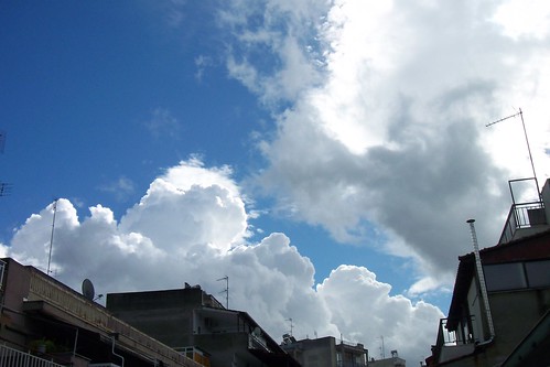
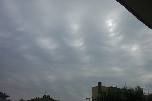
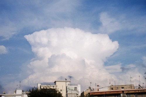
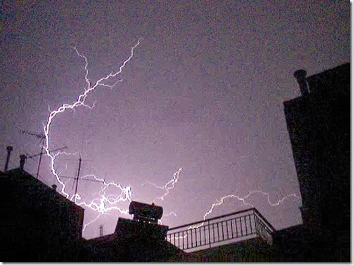
Really dangerous weather conditions are expected from tonigth till Tuesday! There is great risk of floods, wind gusts and severe thunderstorms!
By reading the new forecast update of Estofex, the risk of severe weather is understood! The threat level is upgraded to 3!!!
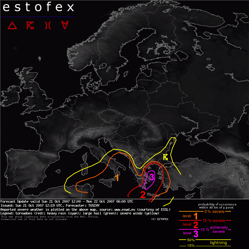
The forecast says:
"Forecast Update
Valid: Sun 21 Oct 2007 12:00 to Mon 22 Oct 2007 06:00 UTC
Issued: Sun 21 Oct 2007 12:19
Forecaster: TUSCHY
SYNOPSIS
Please refer to the outlook issued at Sat 20 Oct 2007 19:52!
DISCUSSION
...S / E Greece, the Aegean Sea and extreme western Turkey...
Latest IR / WV images show a rapid increase in thunderstorm coverage SW of Greece and those storms already exhibit a strongly sheared appearance. It's not necessary to mention that we are in an area with bad data coverage but Tunis 00Z already had 50kt at 500hPa and the 06Z sat.derived wind shear analysis of METOSAT 9 had about 40m/s shear ( 150-300mb layer mean minus 700-925mb layer mean ) with increasing tendency. In addition, the 150-300hPa maps of UW-CIMMS hint on an area of strong upper-level divergence, which developed over northern Tunisia and now affects the area SW of Greece.
It looks like this is the result of a weak short-wave, coming out of the base of the main upper-level trough. Attendant forcing and increasing support of upper-level divergence should help to increase thunderstorm activity during the next hours or so. Those thunderstorms will be the first round of storms, affecting Greece during the next few hours.
The severe weather threat should not yet be too high, as wind field stays quite weak. Still, an isolated tornado can't be excluded comparing the 00Z sounding report of Athinai with the current conditions. A few strong to severe wind gust reports and mostly sub-severe hail can be expected, too.
The main concern /severe weather wise/ should evolve over the level-3 area , starting at 18-20Z south / southwest of Greece and spreading rapidly towards the north/northeast.
The focus for widespread thunderstorm re-development will be a constantly eastward shifting cold front, affecting S-Greece from the west.
Latest synop reports(12Z) locate the front just west of Malta.
In addition we have to deal with the well developed and increasing negatively tilted trough axis and attendant compact PVA field, spreading rapidly northeastwards.
At lower levels a well developed low pressure channel is forecast to cross Greece during the late evening and night hours from the southwest while slowing down somewhat.
Strong moisture advection in the prefrontal airmass, signals of persistent and deep convergence in a nearly uncapped environment and increasing 0-3km CAPE signals raise the confidence of surface-based storms along and ahead of this frontal boundary.
The main reason for upgrading was the persistence of the past few GFS model runs indicating an enhanced risk of widespread severe weather over SE-Greece and the Aegean Sea although there are still some run-to-run variations and hence more or less impressive severe weather parameters, but even in the weaker cases a risk for widespread severe weather would exist.
Another uncertainty will be the quality of the airmass behind the currently ongoing thunderstorms , but we think that impressive forcing and a rapidly cooling atmosphere should easily compensate the potential negative impacts ( e.g. missing insolation ).
As mid-level trough / surface trough and cold front converge Greece during the evening and night hours, wind field in all levels increases significantly ( winds at 850hPa between 25 and 30m/s, at 700hPa about 35m/s ) and shear is quite intense over S-Greece ( SRH1 about 200 J/kg and SRH3 between 400 and 600 J/kg ). Current thinking is that an already organized line of storms enters the level-3 area from the SW between 18 and 20Z, racing N/NE-wards. Dependant on the internal organisation of this line widespread severe-damaging wind gusts can be expected with numerous gusts exceeding 33m/s. As shear vector and expected orientation of the MCS still include a large angle a few discrete thunderstorms can't be excluded with an attendant enhanced tornado / large hail risk...
The severe weather threat then continues to expand northeastwards and should pass over to a widespread severe wind gust risk, as front is located more and more parallel to the intense background flow.
During the early morning hours, severe weather risk should also increase over western Turkey, but main risk will evolve after 06Z and hence is not reflected in this outlook.
Regarding the flash flood threat which is not reflected in our level criterion.
It looks like cold front slows down and stalls somewhere southeast of Greece, maybe affecting western Crete during the night hours. Strong convergence and deep parcel layer depth, coupled with a very moist LL inflow should enhance the excessive rainfall risk, moving slowly eastwards and reaching extreme western Turkey during the end of the forecast period.
...Western Crete..
Better instability and intense shear also favor an enhanced tornado / severe wind gust and large hail risk, especially if the storms stay more isolated due to weaker forcing. The strongest activity can be expected during the latter part of the forecast period as cold front is forecast to slowly approach from the west.
Please refer to the paragraph above regarding the excessive rainfall risk.
...Eastern Romania and extreme northern Bulgaria...
We decided to lower the probabilities due to the marginal risk for severe weather."
*******
And the previous forecast earlier this day, was:
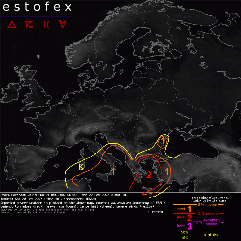
"Storm Forecast
Valid: Sun 21 Oct 2007 06:00 to Mon 22 Oct 2007 06:00 UTC
Issued: Sat 20 Oct 2007 19:52
Forecaster: TUSCHY
SYNOPSIS
Investigating the current European weather maps reveals a very dynamic pattern resulting in a completely disturbed streamline pattern over Europe. To get an understanding about the overall situation we have to describe the streamline pattern upstream a little bit.
During the past few days, very warm air east of North America streamed northwards with temperatures at 500hPa approaching -5°C!
This air now gets incorporated into a developing trough SW of Greenland, spreading rapidly towards the east. As a consequence, pressure begins to rise over the northern Atlantic Ocean, causing a weakening trend of a positively tilted upper-level trough west of Ireland. This in turn temporarily weakens the WAA, supporting a strong ridge over NW Europe, which resulted in the excessively high temperatures well to the north during the past 2 days.
Nevertheless...downstream of this NW-European high pressure area, a pool of very cold mid-level air spreads straight to the south and is accompanied by intense wind fields due to strong geopotential height gradients over southern Europe.
Warm and stable conditions continue over parts of eastern Europe.
DISCUSSION
... Confidence is growing that a high-end severe weather event will be imminent for parts of SE Europe. Please be up-to-date to the latest statements of your national weather services ! ...
... Greece, Crete, western Turkey and the Aegean Sea...
Yesterday, both the 12Z sounding reports and WV loops showed an intense 120kt upper-level jet over southern Germany, translating rapidly towards the south. The jet is forecast to strengthen and will surround the base of an intense upper-level trough placed over Italy during the forecast period, tilting the trough in a strongly negatively inclined position. In addition an intense subtropical jet should merge with the polar jet somewhere south of Greece, resulting in a strongly sheared environment.
As upper-level trough approaches from the west, pressure at lower levels will fall and GFS showed consistent signals during the past few runs that a well developed low pressure channel evolves south of Greece, shifting rapidly towards the northeast during the evening and night hours.
Forcing at mid-/upper-levels will be quite strong as well developed trough axis shifts eastwards ( adopting the aforementioned negative tilted position ).
SSTs of 21-23°C and a rapidly cooling lower troposphere result in a broad area of 500 - 1000 J/kg MLCAPE release, which is not excessively high, but in combination with those kinematic parameters it is more than enough. Mixing ratios of 10 g/kg and more and mid-level lapse rates of about 7K/km also confirm that this amount of instability release looks reasonable.
Thunderstorms should start to develop around 14-16Z south of Greece well ahead of the approaching cold front and thunderstorms are forecast to rapidly increase in coverage.
Another focus for enhanced convective activity will be the cold front itself, racing eastwards and reaching western Crete at about 03Z.
Thunderstorms will also significantly increase over Greece and the Aegean Sea at 22-00Z onwards as upper-level trough approaches from the west / southwest.
Right now there are still some model-to-model and run-to-run uncertainties especially regarding the strength of the surface channel ( resulting in shifts of shear maxima and shear variations over one place from one run to the next one of more than 20m/s ! ).
It looks like that there are 2 areas of an enhanced severe weather risk:
Crete and SW Turkey:
Shear in this area is impressive with 0-3km shear of 30-40m/s!, a belt of 10-15m/s LL shear, 0-1km SRH values of 200-300 J/kg and 600 - 800J/kg SRH at the lowest 3km!
Winds at 850hPa are forecast to reach 25-30m/s and about 35m/s at 700hPa and despite the fact that the atmosphere ahead of the cold front stays quite warm, moderately steepened lapse rates and increasing 0-3km CAPE release hint on an increasing risk of downward mixing of those wind speeds to the surface. Dependant on the final storm mode, severe-damaging wind gusts will be the main threat especially in bowing storms and mesoscale convective systems. In addition, shear vector stands nearly orthognoal on any developing line of storms, increasing the risk of longer lived, discrete thunderstorms.
Strong moisture inflow, deep convergence and not too high LCLs also point to the risk of tornadoes....even strong tornadoes will be a distinct possibility.
The same for the cold front, although main risk should be a severe - damaging wind gust threat. As cold front advances eastwards, it becomes more parallel aligned to the background flow and slows down. This could help to decrease the severe weather threat a little bit during morning hours.
SE- and E- Greece and the Aegean Sea:
Another area of big concern will be southern / eastern Greece, where the ingredient based severe weather forecast method points to a considerably enhanced tornado and severe wind gust risk.
LCLs are very low and as trough axis approaches from the west the wind field at all levels increases ( between 00 and 06Z).
LL shear of 15-20m/s and 250-400 J/kg SRH1 values will be present . We see no reason why storms should not be surface based, as strong and very moist inflow from the southeast establish during the night hours.
In addition, GFS 12Z again increased the winds at 850hPa, which could point to a potential widespread severe wind gust risk.
We decided not to issue a level-3 for this time as it is still not clear which area experiences the worst conditions ( a lot depends on the strength of the low pressure channel ) but parameters point to a potential severe weather event matching our level-3 criterion. Updates, if necessary will be issued later-on.
As a side-note: This looks like to be the first intense rain event since the devestating wild fires during this summer. Missing vegetation and long-lasting dryness over Greece should support a possible high-end flash-flood event.
....Central Mediterranean...
A constantly deepening surface low is forecast to leave the Tyrrhenian Sea during the evening hours, entering the western Ionian Sea during the latter part of the forecast period.
The severe wind gust / tornado threat will be augmented over Sicily as winds at 850hPa stay at 25m/s in addition to strong LL shear ( 0-1km shear at or above 15m/s and SRH1 values of up to 200J/kg ).
Otherwise LL shear will be enhanced over a broad area and as a result, tornadic storms can be expected over southern / central Italy, coastal areas of the eastern Aegean Sea and over northern Tunisia, mainly along the coastal areas, where LL shear gets maximized.
...Eastern Romania and extreme northern Bulgaria...
Although best shear and instability will be displaced, environment is still be conducive for an isolated tornado event. We therefore issued a marginal level-1, which could be downgraded in later updates."
http://www.estofex.org/


