After another storm in Norway called "Vera" (Trøndelag) with winds as severe as a hurricane's (gust up to 38,5m/s)...
http://www.yr.no/nyheter/1.6317683
http://www.yr.no/nyheter/1.6318784
http://www.tv2veret.no/article2413818.ece
...a cold air mass from North pole is about to make Europeans freeze. This air mass is easily seen by the cloud formations and their direction to South.
http://www.sat24.com/frame.php?html=view&country=eu&sat=ir
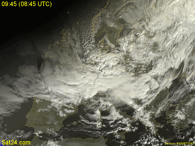
Notice also the Cumulonimbus clouds West of Norway. Some of those has already given snow showers to Stavanger, Kristiansund, Bergen and other towns of Western Norway today (21/11). And if you see the map of snow coverage in Norway, the Southern areas are the only without snow...
The whole country will have negative temperatures tomorrow (22/11) and some snow, that won't come to the region of Agder...
http://www.yr.no/nyheter/1.6318709
Greece won't have much different temperatures than Norway tomorrow! It's going to be warm and windy again in the morning, but in the evening the wind direction will turn to North and the temperature fall will begin. The snow limit will get down to 300-500m in North Greece and there is a possibility to snow along the coastlines of Northeast Greece on Saturday night. Sunday will be cold all over Greece with some phenomena, but the weather will soon get sunny and warmer again on Monday.
Athens forecast:
http://www.weatheronline.gr/cgi-app/reports?LANG=gr&MENU=213
Thessaloniki forecast:
http://www.weatheronline.gr/cgi-app/reports?LANG=gr&MENU=214
Greece forecast:
http://www.weatheronline.gr/cgi-app/reports?LANG=gr&MENU=212&FILE=grfoc
No comments:
Post a Comment